Bedrock x Shone Acquisition
Introducing the next evolution of marine nautical charts,
Web Nautical Charts (WNCs).
The world is broadly in need of better ways to understand what is happening out in the ocean. The most immediately relatable, currently used and adopted method of “ocean maps” are nautical charts. They are often the final end data product of ocean surveys. Current nautical charts represent the fruits of several hundred years of ocean exploration, mapping, and technology mainly for the support of safety of navigation at sea. This used to represent the epitome of exploration - traveling across the ocean.
Navigation at sea has always been something that has bridged science, data, and technology. There was celestial navigation by stars - which still to this day can be used as a backup if all other systems fail. Yet with the evolution of technology, we’ve seen a significant advancement and sophistication in nautical charts. This can be broken up into a few key areas: method of viewing, and use case. But, what’s most interesting to bedrock and this announcement is the way data is used to support nautical chart creation, how it’s stored, and how easily that data is readable and used by many different systems.
Bedrock is proud to announce the next significant technological advancement and therefore new use case(s) that push the boundaries of what's possible (and needed) of nautical charts. This was pioneered by Ugo & Antoine + the Shone Automation team, and we couldn’t be more thrilled to announce our acquisition of this critical piece of technology. We believe this is the next large step forward for all marine charts. This is to support a whole new generation of marine technological innovations, starting with our own.
Currently, there are 2 primary types of nautical charts:
Raster Nautical Chart (RNC): This is simply an Image of charts. You can't query the data that made up the elements of the image. These are often printed on paper or displayed digitally as a static image.
Electronic Nautical Charts (ENC): encrypted data that can be rendered by a computer and displayed on an authorized screen, mainly on ships. Mariners can query data for properties like buoy intervals or local water depth, and can interact with map symbols and areas. They can also have full control over what is shown on the map at different zoom levels. Data is often updated on a USB stick plugged into the specific device on a ship.
Today, we’re sharing a new type of Nautical Chart:
The Web Nautical Chart (WNC).
These are charts not authorized for navigational use, but provide users of web applications a superior, web & cloud-native, API-driven experience for interacting with nautical chart data. The main difference is its developer-friendly for both cloud and autonomous edge development. This technology integration will solve problems that previous methods missed in a cloud-native, linux-driven, & web-based technology development environments.
So sometimes, the best way to tell a story about the future is to start with a story of how we got here.
The current landscape
1. RNC - these started as mariner navigational maps - aka paper images of nautical chart data. Ironically, they're still required to be physically present on commercial ships. Updates are physically written on the paper charts daily by the crews.
Obviously paper is not electronic… so no further explanation needed there.
2. Electronic-based RNC: Chart images (.png, .jpeg, .tiff, etc.) just shown on some electronic screen. These are not usually authorized for navigational use. But they can be sent and shown electronically, like you’d send a friend an image of your family.
While electronic, serving this, and making data accessible to other applications and machines is not possible here either.
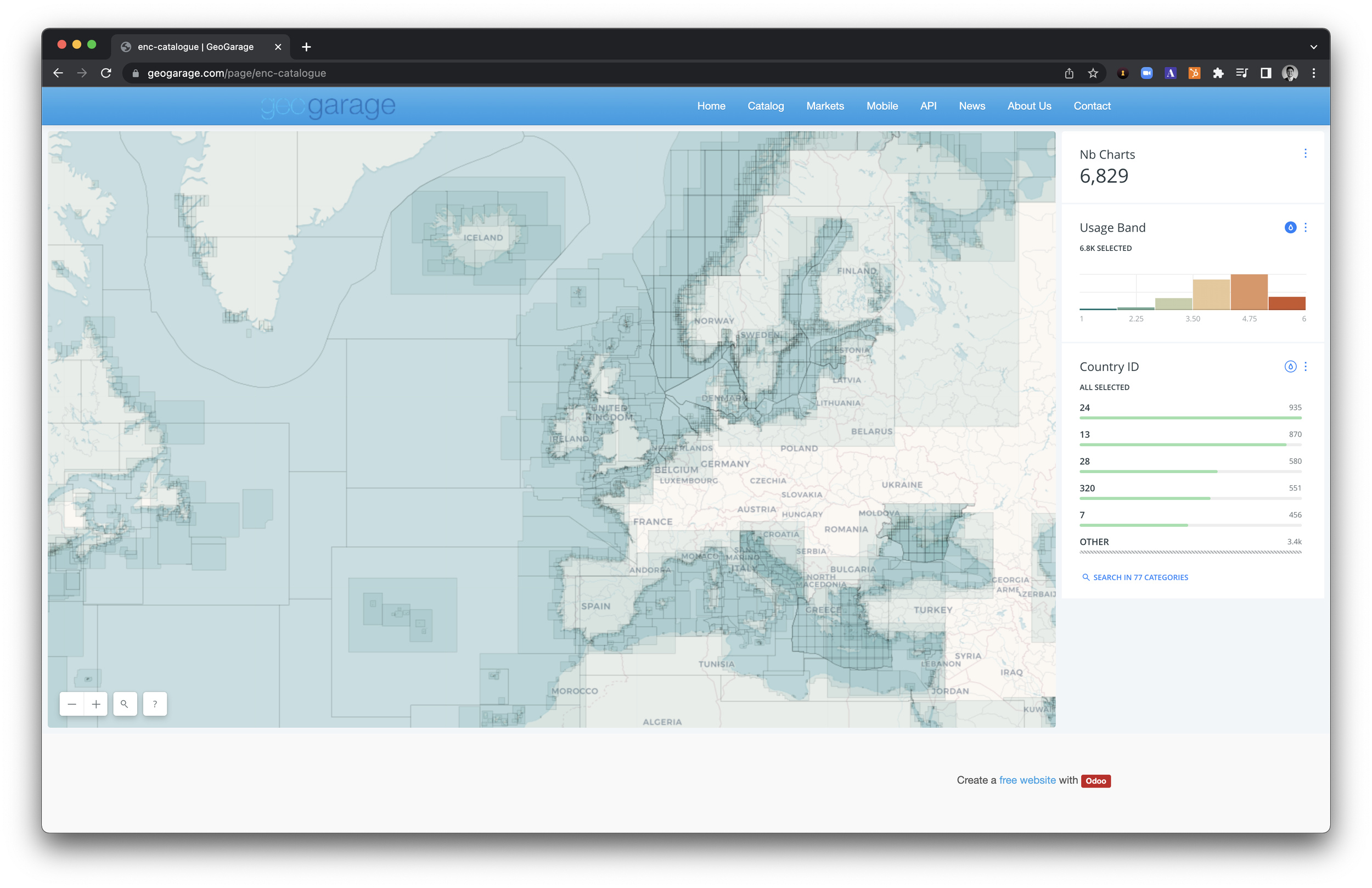
3. Web-hosted RNC: These are web-hosted raster (image) tiles of the above. These images don't allow interaction with the data, but offer view-only access to the charts at fixed zoom levels. The end user cannot selectively display subsets of any of the chart data. Because of the variety of scales and extents of the world's raster charts, there is no good, worldwide, seamless display. Instead these Web RNCs are an ad-hoc tapestry of overlapping and disjointed chart images. An example is Geogarage, a product we deeply admire but doesn’t solve many of the problems modern technology organizations face.
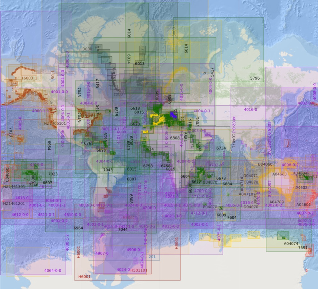
While web serving a tiled raster image is a significant step forward, it doesn’t help a developer understand where a bouy is, nor does it help build a seamless world view of all data - just where different images generated by different governments line up (or don’t in many cases).
4. Enter ENCs. Starting with only regional coverage.
Note: these are legally allowed for navigation at sea.
ENCs were the first attempt at actually enabling the world to interact with the underlying data that was used to create the RNC or paper nautical chart. It was the first big technological step-function improvement that empowered a mariner to use and utilize data beyond human visual recognition of objects on a paper chart. ENCs provide an interactive, zoomable nautical chart where you can do things like click on a buoy symbol and see relevant information about that buoy. Sounds great right? Only catch, they were not designed to be used on non-approved screens and computers. Moreover, these machines were on ships, not connected to the internet because that wasn’t economically possible until the introduction of satellite internet coverage over the oceans.
This meant ENCs were designed for desktop-like environments, only onboard a ship, on a dedicated computer, called an Electronic Chart Display & Information System (ECDIS). The chart data here need(ed)(s) to be updated on a USB stick plugged into this ECDIS because an ECDIS cannot legally be connected to the internet.
While great for a highly controlled and verified set of computer hardware, this has yet to solve the needs of modern web-based, distributed application or device needs at scale.
5. Enter web-hosted ENCs.
Note: this is not legally allowed to be used for navigational purposes.
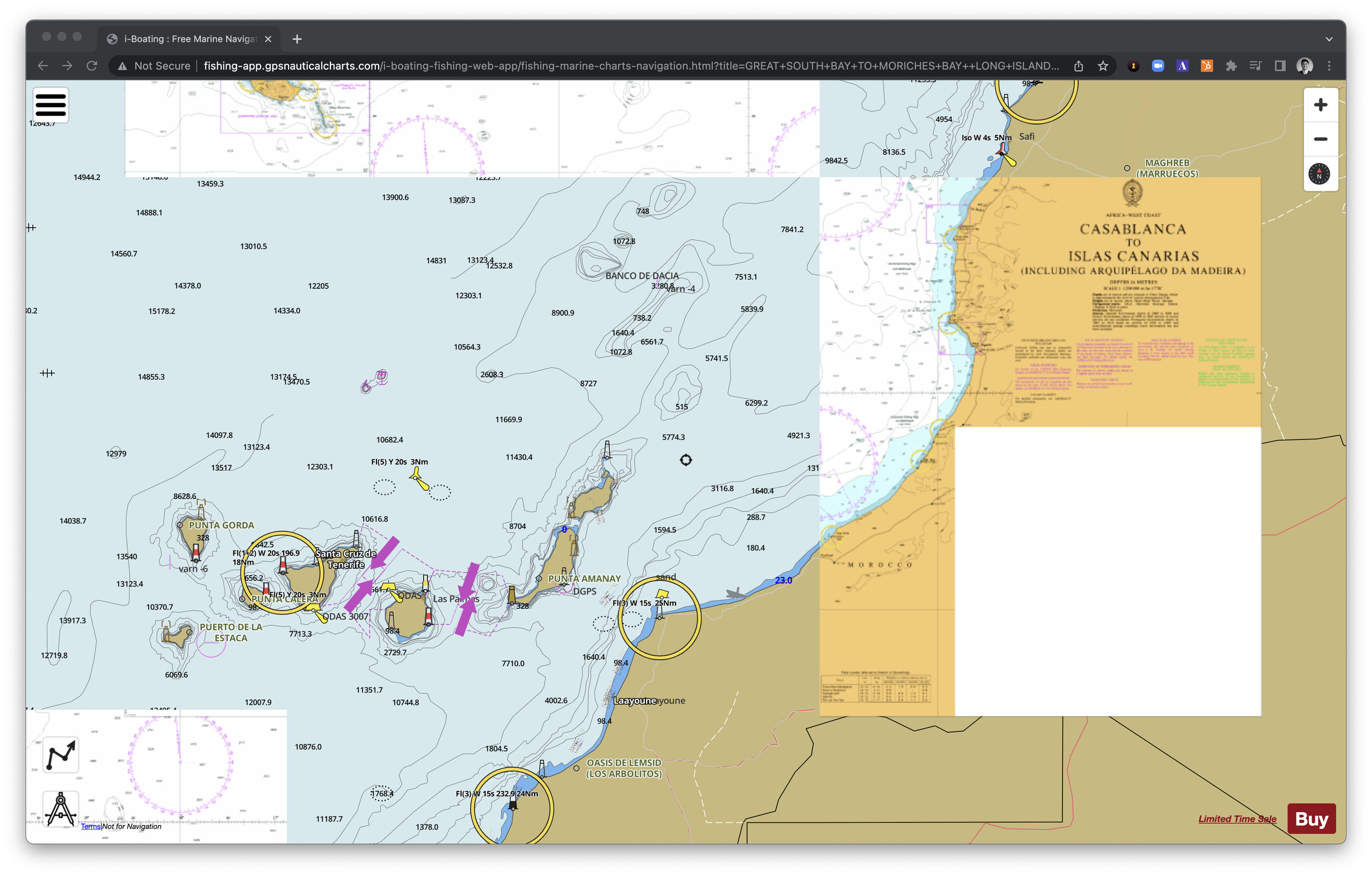
Imagine taking the ENC data directly, and attempting to bring it into a web-rendered environment. It’s still regional. But it demonstrated a significant improvement over ECDIS-only ENCs. To get a sense of what this means see this.
Now I can see navigational chart data, in a zoomable way, in the browser, and there are many resellers of this.
See also this (a blend of web-ENCs and web-RNCs), almost there but not a WNC because others cannot develop on top of it in an API-based, developer friendly fashion. It’s not complete or designed for interaction with all the underlying chart data:
The big issue here, is while this is an attempt at going full web-based, it is not developer friendly. And this here lies the big problem for technologists and the main reason for our acquisition of Shone’s novel web, and vector-based approach to web navigational charts.
Introducing the next technological step-function for technologists, developers, and other modern technology platforms for marine applications:
6. Web Navigational Charts (WNCs)
Built for viewing and interacting with all, truly global, ENC data in a developer-friendly way. Vector-based, API-built charts, for viewing or interacting in a browser, or native linux computer. It enables modern API-driven queryable elements needed for marine app development, maritime navigational domain awareness for autonomous systems (and so so much more). This will first appear as a new baselayer in Mosaic™, as well as powering our internal cloud-based mission planning software, and supporting faster development of our autonomous marine navigation systems.

There is no equivalent available on the market that enables you to reach a good UX with a high level of visual and modern web interactive customizations. Similarly to a pre-Google or Apple maps state, no private company has spent the money to build a complete dataset and make it available for web-based development.
Bedrock is the first one to make that move thanks to this acquisition of Shone’s technology.
To Ugo and Antoine’s credit, Shone pioneered a new developer-first nautical chart technology that we needed to exist for autonomous ship navigation. Bedrock . Shone had already pulled it off. That said, we’re thrilled to welcome their technology into our IP-base and their founders, Ugo and Antoine to assist integrating WNCs into Bedrock’s current technology stack to accelerate our ability to create an exceptional data experience for our customers.
We released this news yesterday on the wire here.
Stay tuned for more announcements on how this may be made more available outside Bedrock. Reach out if it’s of interest!
A huge shoutout and congrats to Ugo Vollmer and Antoine de Maleprade for the acquisition and help with this piece.
Similar shoutout to Charles Chiau and Todd Bryan on the Bedrock team who also contributed to this piece.